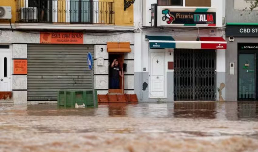
Catastrophic flash floods that have killed at least 72 people in Spain are caused by a destructive weather system in which cold and warm air meet and produce powerful rain clouds, a pattern believed to be growing more frequent due to climate change.
The phenomenon is known locally as DANA, a Spanish acronym for high-altitude isolated depression, and unlike common storms or squalls it can form independently of polar or subtropical jet streams.
When cold air blows over warm Mediterranean waters it causes hotter air to rise quickly and form dense, water-laden clouds that can remain over the same area for many hours, raising their destructive potential. The event sometimes provokes large hail storms and tornadoes as seen this week, meteorologists say.
Eastern and Southern Spain are particularly susceptible to the phenomenon due to its position between the Atlantic Ocean and the Mediterranean Sea. Warm, humid air masses and cold fronts meet in a region where mountains favour the formation of storm clouds and rainfall.
This week's DANA was one of the three most intense such storms in the last century in the Valencia region, Ruben del Campo, spokesperson for the national weather agency Aemet, said.
"Forecasts were in line with what happened. But in an area between Utiel and Chiva, in the province of Valencia, rainfall exceeded 300 litres per square meter. In that area, storm systems formed and regenerated continuously," he explained.
'FINGERPRINTS OF CLIMATE CHANGE'
While experts say it will take time to analyse all the data to determine if this particular DANA was caused by climate change, most agree that an increase in temperature of the Mediterranean and warmer and more humid atmospheric conditions contribute to producing more frequent extreme episodes.
"We're going to see more of these flash floods in the future. This has the fingerprints of climate change on it, these terribly heavy rainfalls, and these devastating floods," said Hannah Cloke, professor of hydrology at the University of Reading.
She said even early warnings of heavy rain based on reliable forecasts did little to prevent the fatalities and people needed to understand the real danger.
"Just telling people that it's going to rain quite a lot, it's not good enough...We could see that people were putting themselves at risk driving in floodwaters, and there was just so much water that it has overwhelmed these places."
Before the term DANA was coined in the early 2000s, any heavy rainfall in the autumn, characteristic of the Mediterranean climate, used to go by the popular name "gota fria" (cold drop) in Spain and parts of France. The term is still widely used colloquially.
Its origin dates back to 1886 when German scientists introduced the idea of "kaltlufttropfen", or cold air drop, to describe high altitude disturbance but without apparent reflection on the surface.
Aemet says the concept of cold drop is outdated and defines DANA as a closed high-altitude depression that has become isolated and separated from an associated jet stream. Aemet says DANAs sometimes become stationary or even move backwards, from east to west.


